
Nathan did this drawing that I think has a surprising similarity to someone that I know quite well so I thought I would steal it and post it. Thanks Nathan.
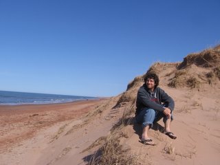
 Thankfully as I review my pictures all the fond memories from those special places flood back to me. Such as the sounds and smells of the jungles as they come alive in the evenings or the warm Caribbean breeze in the morning as you are enjoying the sunrise.
  The past couple days have been a definite change to my routine in comparison to the past three months, but it is obviously nice to be home once again.
 Naomi, for the first time. I should be back on the Island sometime tonight to complete my final stage of transition back to life in North America even though I realize it may take some time.

 The Moreno Glacier is said to be one of the most active glaciers in the world moving up to 2 meters per day. This means lots of calving which is always truly fun to watch.
  Evey time these 60 meter high walls of ice start breaking off to these deafening cracks of thunder then the impact as it hits the water to produce a great surge and billowing clouds of mist is definitely impressive.
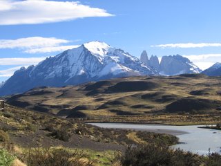
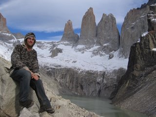 Mirrador los Torres. On looking at the map I was like yikes to view both places it would be over 55 Km and I only had from 1:00 Thursday when the boat drops you off till 2:00 Friday when the bus picks the trekkers up off the trail. Thankfully somehow I was able to make it to both amazingly incredible spots
  (It did take many hours hiking in the dark with my lamp last night and again this morning with a thankfully bright full moon -- as can be seen from the last picture -- taken while I was laying in awe in my sleeping bag).
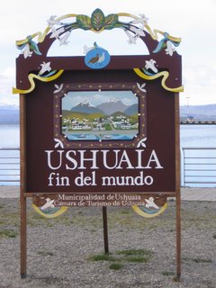 I had a great day yesterday hiking around the Ushuaia area. Overnight there was a light dusting of snow which made for some wonderful pre-dawn hiking in the fresh powder. As the sun rose (not till after 8) I was high enough in the hills to look out over the town below with the snow all a sparkle and the trees all in their fall colours.
  The glacier I was hiking to was not huge, but the area was beautiful with a great panorama of the beagle channel.
  In the afternoon I made it out to the National Park in the area for some more incredible hiking.

 Another notable thing about the park were the thousands and thousands of rabbits that were introduced by the first settlers to the area. They have taken over the park. If I was a fox I would definitely move there for some easy hunting.
  The park lies in close proximity to the Chilean boarder so I unofficially made into, however briefly, the final new country of my journey (country number 17). After the full day of hiking (around 35 Km) I was definitely glad to get back to my hostel for a good night of sleep.
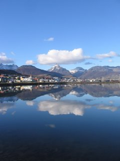
 The flight into Ushuaia was marvelous with all the snow capped mountains and dramatic coast line.
  Walking out of the airport and being able to inhale the cool clean air along with the beautiful views that surrounded me on every side was just what I needed. I'm excited to explore this area more extensively. It was also so nice that Colby (http://www.theholmesargentina.com/) picked me up from the airport last night so I could spend the night at their place before I continued on this morning to Ushuaia.
 Visiting the Sawatskys was definitely the highlight of Sao Paulo, but while I was there I had a number of opportunities to tour around the city.
  One notable stop was to the University of Sao Paulo to visit the Butanta Institute which is home to over 1000 snakes. I saw but a portion of that number, which was more than enough for me (as a kid I really didn't like snakes and I am still not to fond of them -- not about to get one as a pet at least). Another enjoyable event was trying to help out at an all nighter for the middle school that Cary is principle of. I only made it to 4am before I headed back to their house for a couple hours of shut eye.
 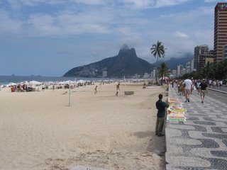 Ipanema beach in Rio de Janeiro.
 Garganta del Diablo from the Argentinian side.
  My head in front of Garganta del Diablo (I did have two pictures taken by another random tourist, but I am guessing he must not have pushed the button all the way down since I can not find the pictures anyplace on my memory card).
  Some other random falls at Iguazu I have no idea of the name of.